 Arctic Physical Map (Map from Geology.com)
Physical Map of the Arctic
This map is the International Bathymetric Chart of the Arctic Ocean which was produced by a team of investigators from Canada, Denmark, Germany, Iceland, Norway, Russia, Sweden, and the USA.
It can be considered a "physical map of the Arctic Ocean" as it shows the bathymetry, ridges and basins that are part of this important area.
Click the map to enlarge.
Below is the metering where the depth of the ocean can be seen.
The North Pole is the deepest area but not far away are the hills of Greenland, making a steep hill from 500 meters above the ocean, to about 5000 below waters near the pole.
The ridge going through the pole is the Lomonosov Ridge.
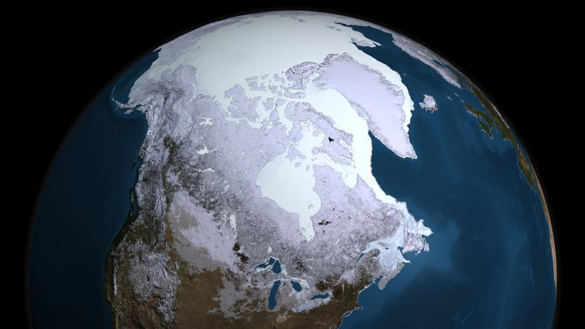
 Map from NASA Goddard's Scientific Visualization StudioSea Ice Map from NASA
This data visualization from the AMSR-E instrument on the Aqua satellite show the maximum sea ice extent for 2008-09, which occurred on Feb. 28, 2009.
This map, or image, is from scientists who research sea ice thickness. The map is a view from North America, a lot of the Unites States can be seen. To the east are Greenland and Iceland.
Maps about minimum sea ice extents are more common then a map like this, which shows that the Arctic most definetly fills with ice every year.
 Chinese Map of the Arctic and shipping route possibilities. Click to enlarge. Chinese view of the Arctic
This is a Chinese map which shows shipping routes from Shanghai in China, through the Arctic via the Northern Shipping Route to Rotterdam in the Netherlands and through the North-East passage to Halifax in Canada.
These three ports are amongst the biggest and busiest transport ports in the world.
Although China is not an Arctic nation they have great interests in Arctic shipping due to its large production shipped to other parts of the world.
China has a research station in the Arctic and is constantly looking at poosibilities to sail through the Arctic Ocean.


