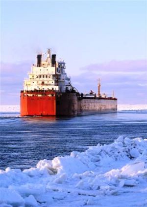
Central Arctic Shipping Route
 (Photo: Getty Images)The passage through the central Arctic Ocean depends on significant reduction of the ice thickness in that area.
Scientific research proves that the multi – year ice cap covering Central Arctic Ocean has been changing drastically over the last fifty years.
As the sea ice continues to melt, vessels with ice breaking capabilities could navigate through the central Arctic waters before the year of 2020. With an overall anticipated temperature increase of 3.6 to 6.2 degrees Fahrenheit by 2050 — and an even sharper increase of 7.2 to 10.8 degrees Fahrenheit in the winter — climate change is expected to have more dramatic effects in the Arctic than anywhere on Earth.
As the sea ice continues to melt, vessels with ice breaking capabilities could navigate through the central Arctic waters before the year of 2020.
The Interactive Mapping System shows a possible shipping track through the central Arctic. Click the box under the map on the right hand side to access the mapping system or view the map of Central Arctic Shipping Route here.
The ones to benefit from the opening of the new Arctic shipping track are surly the northern coastal communities, coastal resource – extraction operations, tourism and fishing operations.
The opening of the new passage with surly shorten the distance between Asia and North America, but with more impact on local, coastal communities of the Arctic states, it will lower the cost of cargo supplies.
Shipping companies will be likely able to cut down the distance rather than sailing through the Panama Canal, Suez Canal or the Strait of Malacca.
More sailing vessels will bring more life into northern communities, making them not only an important stop - over for the ice breaking vessels, but also tourism and travel destination.
Source: National Snow & Ice Data Center , Chinare5


